|
Gustin, Cothern & Tucker |
||
| Land Surveying - Civil Engineering - Hydrographic Surveying - Aerial Surveying | ||
|
Home � Information Reference � Services � Leading Technology � Hydrographic � Surveying � Utility / Route Surveys � Mean High Water Surveys � Civil Engineering � Request A Survey � Feedback � Search Site � Employee Directory |
||
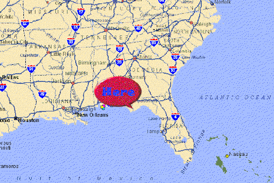
INFORMATION REFERENCECOMPANY HISTORY Gustin, Cothern & Tucker Inc., (GCT) has roots dating back over 75 years. Originally, GCT was a branch office of Bethel W. Whitson Company, which was established in Birmingham Alabama in 1921, and was one of the pioneer surveying companies in that area. GCT began operation in 1982 in Valparaiso, Florida. Valparaiso is located on the North shore of Choctawhatchee Bay, between Panama City and Pensacola, Florida on the panhandle of Northwest Florida. GCT's office is also only three miles from the East gate of Eglin Air Force Base, one of the largest air force bases in the world. The branch office of GCT experienced tremendous growth between 1982 and 1987. In December of 1987, John C. Gustin III, President and Chief Executive Officer of Bethel W. Whitson Company made the decision to reorganized the two companies as Gustin, Cothern & Tucker, Inc.; a Florida Corporation, providing surveying and civil engineering services to the government and private sectors. By 1990 GCT had outgrown it's office in Valparaiso and began construction of a new 7800 square foot office building three miles to the east in the neighboring city of Niceville, Florida. Today GCT is the largest full service engineering firm of its kind in Northwest
Florida, specializing in services such as hydrographic surveying using
multi-beam and other state of the art equipment, Photogrammetric control, construction stake-out with
Real-time Kinematic (RTK) GPS, and residential and commercial civil
engineering. Integrity, experience and innovation has earned GCT the
respect of clients, community, and contemporaries. Eighty years of
service, from three generations of surveyors, make surveying a tradition at
GCT. PROFESSIONAL QUALIFICATIONS Gustin, Cothern & Tucker, Inc. is a Surveying and Engineering firm
with 40 employees. GCT's office in Niceville is a 7800 sf building. The firm is
comprised of:
PROJECT MANAGEMENT TEAM A management team is
assigned to each project. This team will oversee each aspects of a
project, field surveying, design, delivery and coordination with
appropriate agencies. Our personnel are experienced in many different
types and sizes of specialized surveying and engineering tasks. This
experience will help to expedite each project assignment. Total Stations and (3) 4000SE Receivers. ENGINEERING/SURVEY
SOFTWARE
GCT has 20 years experience in
Hydrographic Surveying (12 years with automated systems). Our
firm has owned GPS Receivers and performed GPS services since 1990. Our CADD technicians
use AutoCAD w/Softdesk S8 and Bentley MicroStation w/ Eagle Point Software to
produce digital terrain models and drawing files. Pre and post dredging
surveys, volumes and quantities have been a
regular part of our past Corps contract workload. GCT survey personnel include party
chiefs and instrument persons trained in the use of hydrographic systems, GPS equipment,
total stations w/data collectors and computer interfaces.
Our firm has successfully completed Hydrographic
projects all over the Southeast, including Kentucky and as far away as Minot, ND. Our
firms location affords quick and cost effective mobilization anywhere in the
Southeastern United States. Copyright � Gustin, Cothern
& Tucker, Inc. 2000 |

